
Walk an Albany Street by Address
A useful Albany street search begins by preserving the address exactly as it is known: house number, fractional number if any, street name, suffix, apartment, city, ZIP, and municipality. Albany County includes several municipalities, and an Albany mailing address is not enough to identify Albany City. Start with the parcel identifier, then keep the parcel, legal description, and roll year alongside every later finding. This makes a street directory search repeatable when the same street name appears outside the City or when an older source uses a different form.
The most reliable path moves from the physical address to records keyed to it, then back to the people or organizations named in each dated record. An owner, a directory entry, and a registration result are different kinds of evidence. They should not be collapsed into a current-residence claim.
- Search the address in Albany County PROS and save the parcel or SBL, owner name, situs, municipality, and assessment year.
- Open City MapGeo to compare the parcel shape, nearby parcels, civic layers, and the map date.
- Use PROS Street Finder to browse the named public road, then separate the property location from any owner mailing address.
- Check the recorded-document route through SearchIQS with the owner name, deed book/page, or legal description.
- For a historical household, consult the Albany Public Library directory guide and record the edition and page with the street entry.
Note: A matching address is a starting point, so retain the date and source before comparing one Albany street record with another.
Search Albany Street Parcels in PROS
Albany County PROS is the current property anchor for a street directory search. Its quick search accepts Street Address, Tax Map # / SBL, Owner Name, Street Finder, and Municipality. The address field can be broad, so a search for number and street name can match more than one suffix. The portal advises omitting a suffix such as Street, Road, or Lane. Street Finder is especially useful when the goal is to browse all public-road parcels rather than search one surname.
The owner-name field can cover current and prior owners. Its documented example uses an equals sign before a name to exclude a longer surname match. That precision helps with common names, but a parcel record remains an assessment record. It is not a full title search and does not prove who is present at an address today.
| Albany County PROS Field | Type | Required | Street Search Use |
|---|---|---|---|
| Street Address | Text | Optional | Enter the number and street name; omit the suffix for the portal's broad address matching. |
| Tax Map # / SBL | Text | Optional | Uses the parcel identifier from a tax bill or assessment roll. |
| Owner Name | Text | Optional | Searches current and prior owner names. |
| Street Finder | Dropdown | Optional | Lists public roads for browsing a street. |
| Municipality | Dropdown | Optional | Separates the City of Albany from other Albany County places. |
Albany County PROS advanced search shows the optional street, municipality, sale, value, and property filters available for a narrower parcel search.
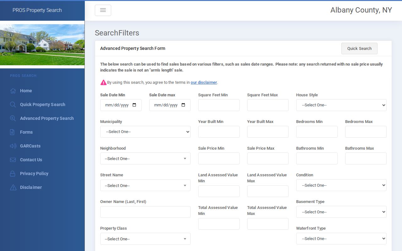
The advanced screen adds property and sale filters, but the public interface did not show a dedicated ZIP field or state a coverage year.
Read Albany MapGeo by Street
City MapGeo offers an address or property quick search and parcel-click browsing. Once the subject parcel is selected, record its SBL, situs, owner mailing address, class, value, and the date shown by the source. Then inspect each adjoining polygon rather than assuming that a nearby address has the same owner or boundary. MapGeo themes can add historic-district, zoning, green-space, and neighborhood-association context to an Albany street record.
The map is valuable for geography, not proof of residence. The inspected City page says parcel boundaries were last revised in July 2020 and City property data in June 2020. A current PROS or assessment-roll date should take priority when those dates differ. The County ArcGIS parcel layer is another public viewer, and its visible fields include owner name, street address, city/state, assessed values, acres, and rezoning fields.
City MapGeo displays a subject parcel and surrounding parcels in the Albany street directory workflow.
Use the map to compare parcels on the same block, then return to the dated roll or recorded document before drawing a conclusion about a particular address.
Note: Compare MapGeo layer dates and parcel boundaries with the assessment-roll date before citing an Albany street finding.
Albany Street Records by Address
Each Albany street record answers a narrower question. The property roll ties a parcel to an assessment year. Recorded deeds preserve legal and ownership transfers. A house or street directory can place a printed entry at an address in one edition. Building and map sources explain the physical place. The Albany County Clerk / Hall of Records keeps the longer chain when an online result stops, while City assessment material is useful for a current parcel reference.
| Address-Keyed Source | Albany Keeper | What It Can Show | Access Route |
|---|---|---|---|
| Current assessment and parcel record | Albany County PROS or City Assessment | Owner name, mailing address, situs, class, SBL, and roll date | Online search and published roll |
| Parcel map | City MapGeo and County ArcGIS | Parcel geometry, civic layers, and nearby polygons | Online viewer; capture layer date |
| Deeds and mortgages | Albany County Clerk / Hall of Records | Grantors, grantees, legal descriptions, book/page, and recording dates | SearchIQS, public indexes, counter, mail research |
| Street and house directories | Albany Public Library and Hall of Records | Printed address entries, street order, wards, or later ZIP references | Library desk, appointment, archive research, and listed digital volumes |
| Building permits and maps | City portal and Hall of Records | Work, physical-change, and address context | Online portal when available; older material may require staff help |
Albany City Assessment maintains current and tentative roll links and identifies the City assessment office.
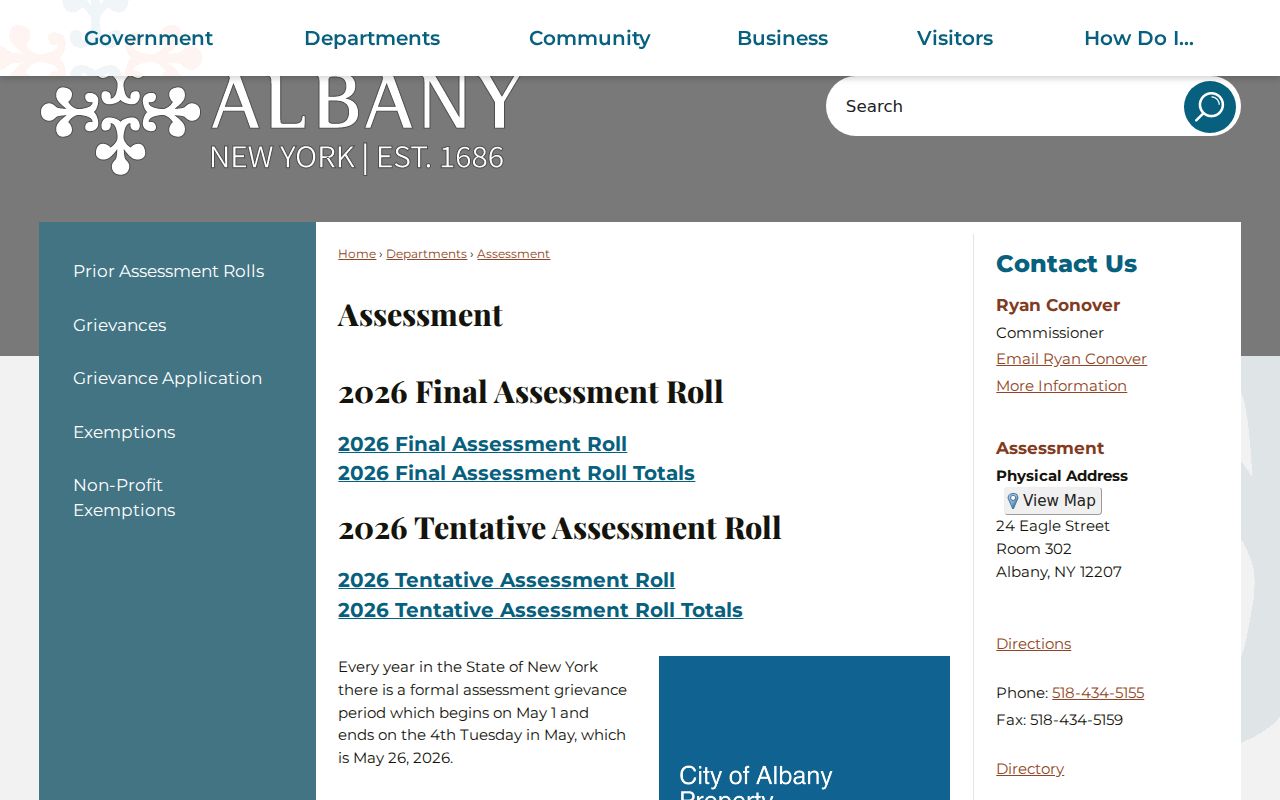
The assessment route supports a parcel-first search, but an owner mailing address and property location must remain separate fields in any Albany street directory notes.
Match Albany Street Names and ZIPs
Normalize an Albany address before searching. Keep the number, street spelling, suffix, apartment, ZIP, municipality, parcel or SBL, and source date. ZIP code, neighborhood, ward, school district, municipality, and parcel are distinct geographies. USPS provides the authoritative address-to-ZIP result, while PROS and the roll identify the parcel municipality. A ZIP may cross a City boundary or serve an institutional or mailing purpose.
That distinction matters on streets near municipal lines. Albany research material specifically warns that ZIPs 12204 and 12205 cross City-limit analysis. The County system covers three cities, nine towns, and six villages, so a street result should not be labeled Albany City just because its mailing address says Albany, NY. Record the municipality with the parcel and use the postal result only for delivery geography.
- Parcel
- A mapped property unit used in the tax and assessment system, commonly identified by an SBL or tax-map number.
- Situs address
- The physical property location. It can differ from the owner's mailing address.
- Plat
- A mapped subdivision or land plan that can help identify a legal parcel when the street address changes.
- Criss-cross directory
- An address-first directory route that leads from a house number to a printed name or household entry.
Note: Keep delivery ZIP results separate from municipality and parcel identifiers when recording Albany address results.
Albany Street Guides Through Time
Albany's address guides change their format over time. General city directories begin in 1813, the first street directory appears in 1872, and street guides list wards from 1897 through 1965. House directories begin in 1895H and 1896H, resume in 1914, and add cross streets in that later run. In 1932, house and street material merged. From 1943 the combined guide is called a Street and Avenue Guide or Street Directory, and ZIPs by street begin in 1967.
Those dates are a practical search tool. A known address from one period may be easier to find under a house directory, while another period requires a street guide or a general directory. Cross streets can anchor a block after 1914, and ward numbers can help locate an earlier entry. The Library's Pruyn Collection has nearly complete city directories from 1813 to the present, with its Local History Room available by appointment and staff able to retrieve directories when that room is closed.
Note: Record the edition, street-guide section, page, ward or ZIP column, and spelling exactly as printed before comparing Albany street directory entries.
Albany Street Names and Honorary Signs
A street sign may carry an honorary name without changing the official name used by records. Albany's Honorary Street Namings rule says an honorary name does not replace the official street name and does not require re-addressing. Search the official name first, and store an honorary name as a civic overlay rather than a substitute address. This avoids a false missing result in a street directory or deed search.
The City building-number rule also makes the current number an administrative value, not proof that historic directories used the same numbering. The Commissioner of Assessment and Taxation assigns a unique building number when a number is inconsistent, and certificates of occupancy show the building number and street. For older research, test former names, ward, cross street, parcel, and legal description before deciding an address disappeared.
Albany's building-number code shows the current address-assignment rule used alongside City records.
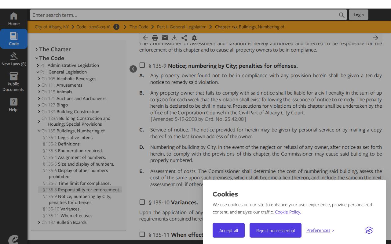
The current code helps interpret an address, while a dated street guide or deed supplies the evidence for an earlier form of that address.
Follow Albany Street Deed Records
Use the current parcel or SBL to start the deed trail. SearchIQS provides recorded-document access for Albany County, with deeds and mortgages generally indexed and imaged from 1980 forward. For a returned deed, record the document type, recording and document dates, grantor, grantee, property or legal description, municipality, book/page, party role, image indicator, and exact query. The deed image and legal description are evidence; an index row is a finding aid.
Work backward by following the prior grantor, not only the modern street wording. Earlier routes remain important: deed index books list grantors from 1922 through 1979 and grantor corporations from 1940 through 1979; deed record-book images run from October 20, 1908 to January 4, 1980, books 581 through 2181. The Albany County Clerk / Hall of Records has public indexes for earlier chains, and older material may be offsite with up to a 24-hour retrieval period.
SearchIQS data availability describes the document-type coverage and older deed and mortgage book ranges. A Clerk visit or mail request should include the parties, approximate date, and book/page when known. The Clerk does not accept email or fax search requests when payment or copy fees must accompany the request.
Note: A no-result statement should name the index searched and its date range, rather than claim that no earlier deed exists.
Albany Street Permit Trails
City Citizens Self-Service, also called EnerGov, adds address-based permit and code context. Its public-facing categories include building, plumbing, electrical, and elevator construction permits, permit status, inspector, permitted work, code cases, and selected registry information. These records explain work or a physical change at an address. They are not an unrestricted list of people connected to a street.
Data older than 2023 may not be online. In that case, contact Buildings & Regulatory Compliance with the record number, or use the Hall of Records finding aid for the 1909 to 1925 building-permit index and related maps, water-rent material, or inactive records. A City FOIL request is the route for City records not displayed by a portal and should identify names, dates, and the record sought.
Albany Citizens Self-Service describes the permit, code, and certificate portal.
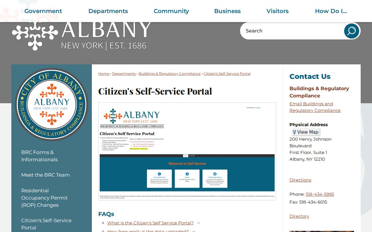
Pair a permit result with its address, record number, and date, then use deeds or directories for the separate ownership or household question.
Use Albany Voter Records Carefully
The NYS Poll Site Search, Voter Registration, and Mail Ballot Tracker is not an Albany street directory. Its public match requires County, last name, first name, date of birth, and ZIP, and the inspected form has no separate full-street-address field. It is intended for a registered New York voter's registration, poll-site, or ballot-tracker status. Do not turn a result into a list of names for a block.
For historical work, the Hall of Records lists Enrollment of Voters from 1941 to 1969 and Register of Voters from 1899 to 1966. Its street research can use a ward before consulting that material. Current public election records are subject to Election Law limits, including a prohibition on non-election use of voter data, and protected or confidential voter records must not be reconstructed from a missing result.
Use the NYS Poll Site Search only for its stated registration and poll-site purpose, and seek an official records route when a historical source is needed.
Note: Historic voter registers are time-specific records, and their accessibility does not create an unrestricted Albany address directory.
Limits of an Albany Street Directory
An Albany street directory does not establish a complete list of everyone at an address. A tax-roll owner can be a prior owner, corporation, estate, or person with a different mailing address. A printed directory entry reflects one edition and may be delayed, omit an apartment, use a business address, or show a move or death notation. Map boundaries and tax-roll dates also change. The strongest statement is limited to what a dated record actually says.
Use at least two independent, time-matched sources before connecting a person to an address. A directory plus an assessment or deed can support a historical finding when the year and place agree. If they conflict, keep both dates and labels. Do not infer a protected address, a private current location, or a household relationship from a partial result.
Lawful use. Albany street and address records support personal, lawful research and property history. Do not use any result to stalk, harass, intimidate, or harm another person.
Cite an Albany Street Search
A useful citation preserves the address as searched, municipality, SBL or parcel, source name, roll or edition year, page or deed book/page, result date, and the role named by the source. For an old street result, include former name, ward, and cross street when printed. The Albany County Clerk / Hall of Records can supply the counter, mail, and archival routes when the online index or a library volume does not reach the required year.
Visit the Clerk for no-fee in-person self-search when appropriate; pre-1980 Clerk searching can carry a $5 search fee. The Hall provides in-person assistance and mail research at $20 per hour, with on-site copies at 50 cents per page and written certification at $4. Email or fax requests are not accepted when payment or copy fees must accompany a Clerk search.